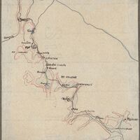
Hand drawn Map of walking trail taken by Lamb with a group of friends 25th-31st March, 1923
Item
-
Title
-
Hand drawn Map of walking trail taken by Lamb with a group of friends 25th-31st March, 1923
-
Chronological Range
-
1923
-
EMU IRN
-
188418
-
Reference Number
-
LAM/3/1/5/37
-
Extent And Medium
-
1 Hand drawn map
-
Scope And Content
-
Depicts a walking trail starting at Diakofto through Mt Kyllene and ending at Mycenae. Various sites stopped at along the way include: Megaspileon, Diakophto, Kalavryta, Tsivlos (and the lake), Mt. Chelmos, Solos, Peristera, Sevista (Stenos?), Zarouchla, Mt. Krathis, Sevitsa (Stenos), Pheneos, Mt. Kyllene, Stymfalia, Alea, Dunka and Myceane are noted and reflected in the photos that follow (LAM/3/1/5/38 until LAM/3/1/5/95)
 Volume VI
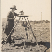 Winifred Lamb Personal Papers